

Key Insights
Wat Pha Lat was engineered as a hydraulic waystation for medieval pilgrims ascending Doi Suthep, not an isolated mountain retreat.
Combining fourteenth-century Lanna stone routing, British-era Burmese teak architecture, and twentieth-century Phra Nak Anurak forest ordinations, the site remains an active material record of how sacred ritual, water engineering, and ecological defence converge in Northern Thailand’s mountain landscape.
Dipterocarp: A family of hardwood, resinous tropical trees common in Southeast Asian forests, dominant along the lower ridges of Doi Suthep.
Kuti: A modest monastic living quarter or monk’s hut, traditionally built from raised timber to prevent moisture accumulation.
Viharn: A primary sermon and assembly hall in a Buddhist monastic complex, used by monks and laypeople for rituals and teachings.
Pyatthat: A Burmese multi-tiered, spired roof structure adorned with ornate stucco or wood carvings, commonly crowning shrines and sacred pavilions.
Buat Ton Mai: The ritual practice of “tree ordination,” where Buddhist monks wrap sacred saffron robes around old-growth trunks to grant them spiritual protection against logging.
Bindabat: The Theravada Buddhist practice of the morning alms round, where monks walk through the community with iron alms bowls to receive food from lay practitioners.
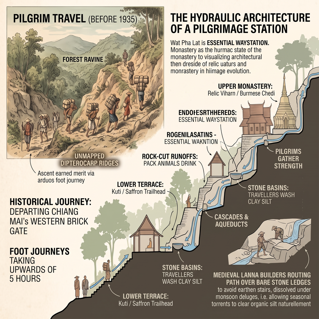
Before Kruba Srivichai mobilised thousands of regional volunteers to construct the motor road up Doi Suthep in 1935, pilgrims ascending the sacred mountain climbed through an unpaved forest ravine. Foot journeys departing Chiang Mai’s western brick gate took over five hours across unmapped dipterocarp ridges.
This steep ascent required pilgrim caravans to rely on engineered waystations integrated directly into the mountain’s granite contours. Wat Pha Lat—literally the “Monastery at the Sloping Cliff” – served as an essential hydraulic waystation rather than an isolated hermitage. It provided key infrastructural functions:
The site marks the physical convergence of fourteenth-century Lanna territorial planning, British-era Burmese timber wealth, and late-twentieth-century environmental activism across a single cascading shelf of rock.
The Hydraulic Architecture of a Pilgrimage Station
The trail follows the natural drainage line of the Huay Kaew basin, rising roughly 250 vertical meters over two kilometres of packed laterite and exposed bedrock. Medieval Lanna builders avoided cutting standard earthen stairs, which quickly dissolved under the weight of monsoon deluges. Instead, they routed the path over bare stone ledges.
This deliberate alignment allowed seasonal torrents to clear organic silt from the trail bed naturally without dislodging the structural base stones.
When King Kue Na founded the mountain-top reliquary at Wat Phra That Doi Suthep in 1373, intermediate stations like Wat Pha Lat formed the backbone of regional pilgrimage logistics.
The complex straddles an active split waterfall. Its lower platforms rely on rock-hewn aqueducts. These channels divert mountain runoff away from structural pilings. The flow cools the raised timber living quarters (kuti). Simultaneously, it replenishes communal washing basins.
The site altered dramatically during the early twentieth century. Flush with liquidity from the Bombay Burmah Trading Corporation’s logging concessions, Burmese merchant Tai Toung bankrolled a massive restoration of the compound’s core shrines. He raised an octagonal brick chedi and crowned the viharn pavilions with tiered roofs.
The surviving layout presents a rare syncretic profile. Sweeping Northern Thai timber rooflines rest on Burmese masonry platforms adorned with stepped stucco pyatthat spires. This architecture documents the frontier wealth generated during the twilight of the northern teak boom.
Sacred Geography: From Valley Settlement to Mountain Summit
The Monk’s Trail is not merely an isolated forest footpath. It serves as a vital umbilical cord within Northern Thailand’s broader cosmological and urban axis. In classical Lanna territorial planning, the sacred mountain served as the spiritual anchor for the fortified city below.
Early architects oriented religious monuments, hydraulic waterways, and cardinal defense lines across the valley. Understanding these systems provides critical context for the city’s built environment. Our broader survey details this complex Chiang Mai heritage.
Ascending past Wat Pha Lat’s hydraulic terraces, the trail steepens considerably toward the upper granite ridge. Here, the final pilgrim ascent culminates at the mountain’s crown reliquary, where fourteenth-century territorial cosmology and royal relic placement define the historic significance of Doi Suthep and Chiang Mai’s mountain heritage.
Viewed together, the valley floor, intermediate waystation, and summit shrine form a continuous, tripartite sacred landscape.
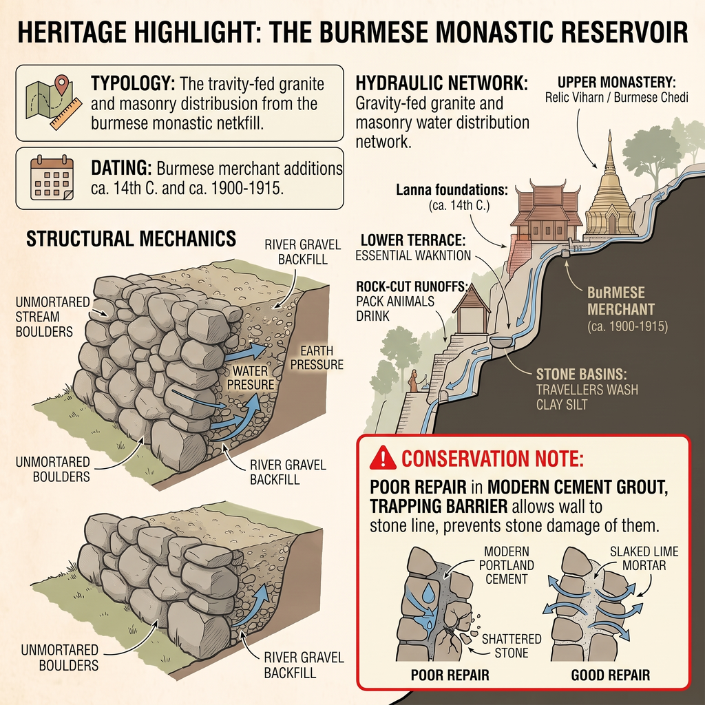
Heritage Highlight: The Burmese Monastic Reservoir
Forest Ordinations and Modern Spatial Tension
Orange sashes knot the dipterocarp and shorea trees along the trail. They are neither decorative markers nor casual offerings left by visitors. Instead, they remain physical remnants of Northern Thailand’s Phra Nak Anurak (Ecology Monk) movement. This grassroots campaign emerged in the late 1980s and 1990s to counter rampant deforestation.
To halt illegal timber extraction along the Doi Suthep park perimeter, resident monks conducted formal ordination rituals (buat ton mai). Wrapping a sacred saffron civara cloth around a centuries-old trunk integrated the tree directly into the monastic fold.
Under local Buddhist ethics, cutting an ordained tree equaled assaulting a living monk. Commercial loggers dared not cross this religious boundary line.
Today, this ecological buffer faces a distinct modern friction. Between 06:30 and 08:30 each morning, two competing routines intersect within the same narrow corridors:
Field Analysis & Material Integrity
The lower monastery grounds retain remarkable material integrity. Visitors need only look beyond the concrete patches applied during late-twentieth-century repairs.

To evaluate the compound’s preservation state, examine the junction points between the Burmese brickwork and the underlying Lanna foundations:
The Verdict
Wat Pha Lat survived the obsolescence brought by the 1935 road because of its functional engineering. Built into the living bedrock, it remains an authentic material record of medieval craftsmanship.
Northern Thai builders skillfully tamed the steep mountain topography. They united timber carpentry, hydraulic routing, and ecological defence. All this existed long before modern highways remapped the valley.